Living Memory South Murwillumbah
Project
South Murwillumbah has a rich history, but there's a notable absence: no accessible environmental history exists that brings together the stories of this place and its people.
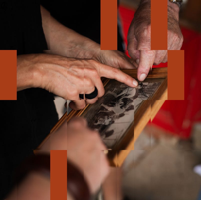
As part of Living Memory South Murwillumbah historian Jo Kijas is addressing this gap. But her research depends on more than archival material — it also needs to include knowledge held by South Murwillumbah residents themselves.
For some of us living in the Northern Rivers region, floods have been the foremost natural hazard. Increasingly, responses to natural disasters are shifting from recovery to long-term, knowledge-driven preparation. This requires grappling with the interwoven histories of people and place—environmental histories that can help build safer, more resilient futures.
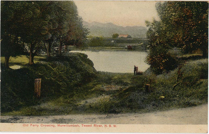
1901 old ferry crossing between Murwillumbah and Southside. Photo courtesy of Tweed Regional Museum.
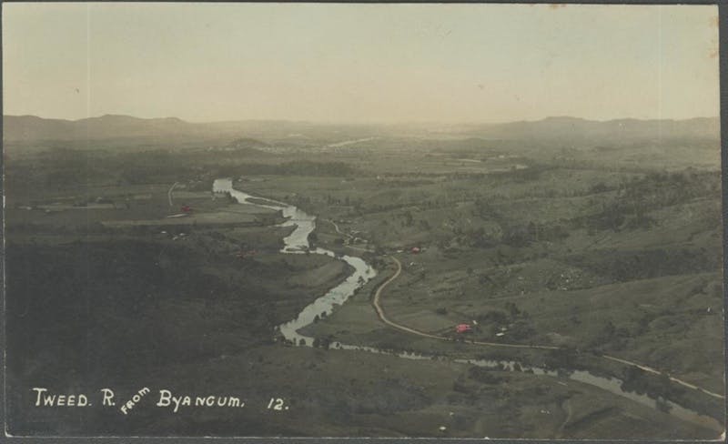
c1920 aerial view meandering downstream from Byangum. Photo courtesy of Tweed Regional Museum.
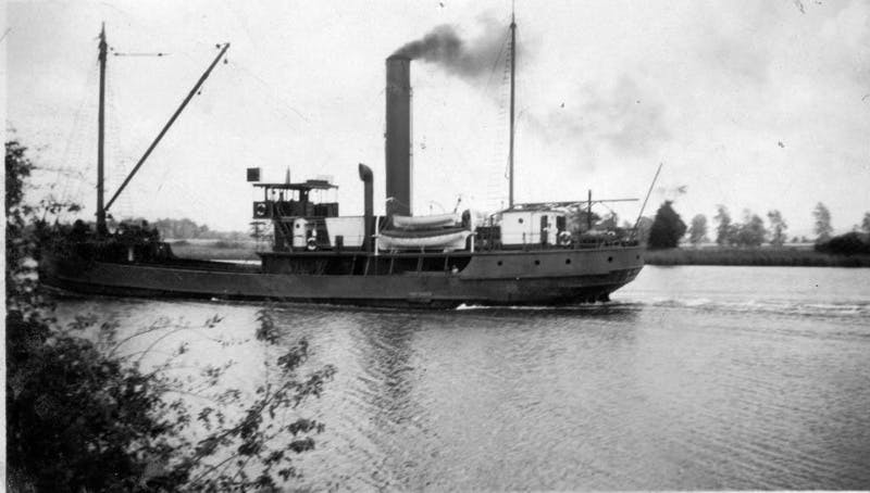
Steam boat at Murwillumbah 1930. Photo courtesy of Tweed Regional Museum.
South Murwillumbah Matters
Throughout February—April 2026, a curated series of historical stories 'South Murwillumbah Matters' will be shared through Facebook page It Takes A Town.
Jo will be sharing a geographical context, early settlement history, flood records and community stories. Each post invites contribution—residents adding their memories, corrections, photographs and observations to build a richer picture of place.
Understanding our past enables us to prepare for our future. True adaptation isn't found solely in infrastructure or government programs—it lives in the social knowledge and community connections, built in place, that sustain people through adversity.
Do you have something to share?
We're seeking your stories, images and memories—from last week and last century—about South Murwillumbah and your relationships with the river.

The river was the road
Well into the nineteenth century, Europeans travelling into Tweed Bundjalung Country came winding up the river. The dense forest landscape that impeded their access was described by surveyor, John Uniacke, who rowed a few kilometres upriver with John Oxley in 1823. ‘The scenery here exceeded anything I have previously seen in Australia – extending miles along a deep rich valley clothed with magnificent trees, the beautiful uniformity of which was only interrupted by the turns and winding of the river…’ Oxley named it after the River Tweed in Scotland.
Bundjalung people and their visitors travelled across their country on the more sparsely covered ridges. They drank from the springs rather than the river, usually camping beyond its banks and above the mosquito and snakey resource-rich swamps.
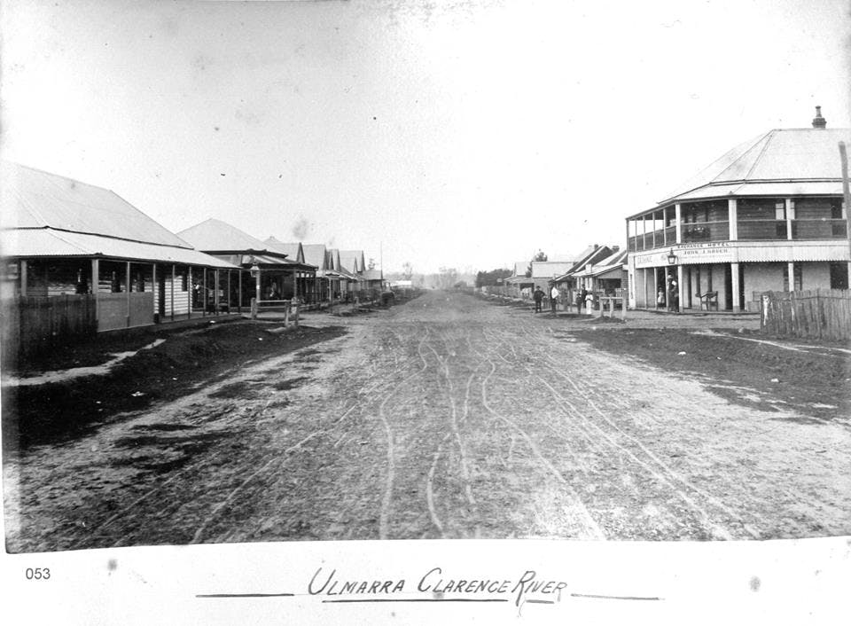
A few cedar getters set up their first camp in 1844 at Terranora, moving further inland around Murwillumbah by the mid-1850s. Samuel Gray and his brother-in-law Joshua Bray took up pastoral leases in the early 1860s, and farmland slowly became available in the valley from 1866, carved out of the forests on the high banks of the river.
Murwillumbah was slow to develop, gazetted in 1879. The coming of the railway to South Murwillumbah in 1894 brought on housing and businesses, and a bridge across the river was opened in 1901, replacing the punt. Cane and dairying replaced the forests.
By 1901 Bray, who had recorded language and culture of the numerous First Nations people around Murwillumbah, stated that ‘the blacks have almost died out’. The ‘Great Australian Silence’ had started to descend on Bundjalung people of the Tweed Valley beyond the coast.
Changes made to the landscape and waterways by the newcomers, and in turn nature’s impact back onto settlement, will be explored in future posts.

Stories from the river
The river, and its many tributaries, has always been full of stories. The geography and hydrological flow of the river starts its fall towards the sea off the cliffs of the Border Rangers.
For Bundjalung people, their ancestral river journey starts from the sea. Until 18 July, the Tweed Regional Museum celebrates the origins of the Bundjalung Nation, including the Three Brothers creation story, in their new exhibition The Wiiyaan. Learn more https://brnw.ch/21wZ5Uv
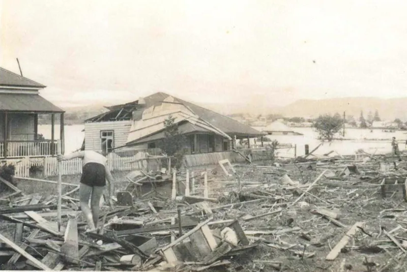
Stories of floods and freshes were present for the European newcomers from early in their arrival. But so were other stories, such as the danger of sharks to dogs and others. Tidal water moved beyond Murwillumbah, and in warm weather the media often warned swimmers of sharks. Following the opening of the South Murwillumbah swimming pool in 1934, the caretaker cautioned river swimmers to pay a small fee and patronise their shark-proof enclosure.
And more recently, is there anyone who salvaged beer from the bottom of the river off the Southside banks in 2001 after that truck took a dive? Or even later flood beer? Please tell us some of your stories.

The Tweed River catchment
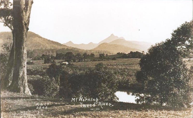
Wollumbin/Mount Warning rises up out of the Tweed Valley viewed through ancestral lore, science, history and the present. The Tweed River begins here, in the caldera of the Tweed Shield Volcano. The caldera is the hollow that formed when the massive volcano collapsed after a series of eruptions over 20 million years ago. Wollumbin at its centre, from a geological viewpoint, is the central plug which is the hardest and last part of the volcano to erode, surrounded by its ring of mountain ranges.
The fast-running streams that cascade off the steep sides join to form the three arms of the Tweed system – Rous River in the north (meeting the main river at Tumbulgum), Oxley River in the middle, joining the Tweed (south arm) just above Murwillumbah at Byangum. The fresh waters are further fed by shallow alluvial groundwater and springs that are essential to maintaining flows between rainfall.
The Tweed starts to ‘meander’ at Bray Park. It continues meandering across the flood plain before flowing out to sea at Tweed Heads. ‘Active meandering’ is part of the Tweed’s natural habit across the open valley. Previously reaching Byangum, today the tidal/salt limit reaches Bray Park Weir.
The catchment area of c.1,326 square kilometres means it is the smallest of the Northern Rivers catchments. Neighbouring Richmond River catchment, for example, is about 7,000 square kilometres. However, the runoff response time, where water travels over the land surface rather than being absorbed into the soil, is the fastest of all our North Coast rivers.
What do you know about the rivers that the history books might not tell us?
What have you noticed about how the Tweed behaves as it flows past South Murwillumbah?
How would you describe the Tweed over time to someone who's never seen it?

The changing land and waterscape
The thick, dark rainforests of the Tweed Caldera started to establish after volcanic activity ceased, with drier forest and coastal heath stabilising from about ten million years ago. Lowland subtropical rainforest spread across the valley interspersed with vast swamps.
The first timber getters were looking for individual trees, in particular red cedar. They established a small camp at Terranora in 1844, logging the riverbanks. By the mid-1850s there were inland camps including at Kynnumboon near Murwillumbah. Episodes of violent conflict occurred between the loggers and Bundjalung clan groups. Measles was reported to have killed a third of the Bundjalung population at the time.
The contained valley with its steep mountain sides meant there was little room for the squatters and their flocks, unlike the other big rivers of the North Coast. Despite the havoc of disease, Joshua Bray who established his lease at Kynnumboon recorded 600 Bundjalung camped there in 1866.
Everything changed after the closer-settlement acts. By the late 1860s the forests were starting to be clear-felled and burned for small farms. One commentor remembered back to the 1890s: ‘… young grass springing up amidst the blackened logs, stumps and rocks, changing the landscape into green, and fencing and building ready for future dairying.’
In 1914 the South Murwillumbah correspondent for the Tweed Daily noted: ‘We are cutting out millions of feet [of timber] a year and very little attempt made to provide for future requirement after our forests are devastated.’ He pointed to lessons he felt should have been learned following the ‘wholesale destruction’ of the Dorrigo Plateau forests (1890s).
Image courtesy of Tweed Regional Museum.
Project collaborators
Dr Jo Kijas
Jo is a consultant historian and Adjunct Fellow at Southern Cross University, specialising in environmental, community and settler-colonial history with a focus on oral history practice. She has published widely, including nine commissioned histories and multiple award-winning projects. She is co-author of two Tweed Regional Museum publications: The Other Side of the World and Caravans and Communes: Stories of Settling in the Tweed.
Jo runs oral history workshops and has contributed to major heritage initiatives such as Lismore’s Wilson River Experience Walk. Her work explores the histories of rivers, wetlands and remnant landscapes across the Far North Coast.

Elise Derwin
Elise is an award-winning photographer based on Bundjalung Country in Lismore, NSW, specialising in documentary and editorial photography.
Her images have featured in the Sydney Morning Herald, The Guardian, The Australian and other major newspapers. Elise has worked extensively across Australia, particularly in the Northern Territory, and completed assignments in the United States, Timor-Leste and Indonesia.
Fuelled by genuine connection to people and places, Elise aims to capture whole stories, not just moments. By taking time to know her subjects, she tells important, often personal stories through images filled with humanity and compassion.
Living Memory South Murwillumbah received funding from the Australian Government through the Northern Rivers Recovery and Resilience Program, administered by NSW Reconstruction Authority.